Firstly, in the temporary absence of the tracker, I made a guess about how far Mark would have progressed along Interstate10 yesterday and plotted it on Google Earth...

 which, in the 'bigger picture' , looks like this. With the tracker now back in operation and confirmation from the web diary of Mark's whereabouts, it looks like it was a good 'guestimate'!
 Getting back to the wind power... between Fort Stockton and Bakersfield, there is an area where there would appear to be literally dozens of wind turbines on the high plateaux to the north of the road. Close up they look like this - it is the black shadows rather than the turbines which are the visible evidence. (To give a sense of scale each turbine is taller than the Empire State Building. )The 107 turbines of Desert Sky Wind Farm on Indian Mesa produces enough electricity to power 54,000 homes and is sold to the municipal electricity utility of the city of San Antonio. There is some excellent information about the project here (click banner to link) including a very good video...


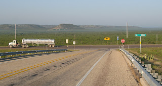
 For tens of miles in all directions there is a network of cleared patches carrying small derricks and 'Christmas tree' wells linked by access tracks used by tankers such as the one above to collect the oil. This pattern is particlarly well exemplified by the area of the Yates Oilfield which is to the east of Bakersfield and north of
  the Interstate 10 near to the town of Iraan...
The pattern is also captured by the NASA image below which carries the following accompanying information ...The Permian Basin of west Texas and southeastern New Mexico is one of the most productive petroleum provinces of North America. The area holds one of the thickest deposits of rock from the Permian Period, which lasted from approximately 290 to 251 million years ago. The Basin is a large depression in the bedrock which filled with thick layers of sediment during the Paleozoic Era (about 545 to 251 million years ago) as the region was alternately covered by shallow oceans, or exposed as coastal salt flats. The sediments hardened into organic-rich carbonate and minerals such as common table salt. Later activity in the Earth’s crust caused folding of the sedimentary layers, creating ideal conditions for the formation, trapping, and storage of petroleum. In this NASA photograph, numerous white well locations and petroleum drilling structures mark the Yates Oil Field. The nearby city of Iraan, Texas, is named for Ira and Ann Yates, the owners of the land where oil was initially discovered in 1926. The Yates Field started petroleum production in 1926, and by 1995 had produced over 2 billion barrels of oil. While the Yates Field was still actively producing oil and natural gas in 2006, new petroleum discoveries in the area were considered unlikely due to the already-dense well development.

 And although it's slightly off-location, after yesterday's ranching and today's oil wells, I couldn't resist this.....
That takes me back a year or two!
End of day yesterday was at Ozona which advertises itself as 


No comments:
Post a Comment