 I have just read what I posted yesterday and I am concerned that I may have given the impression that the Indus valley is some sort of Shangri La with a completely different climatic regime to the Balochistan plateau from which Mark has recently descended. Apart from the temperature differences which are related to altitude, the rainfall regime is little different - perhaps a little wetter but not a lot! The annual rainfall totals for towns in the middle Indus valley still fall well below 250mm and are therefore technically desert figures. To the south and east of the Indus is the Thar desert which extends into north west India. Therefore, like the Nile in Egypt, the Indus crosses a desert and it is only due to massive engineering and irrigation works along its course that the area can be 'green'.
Coincidentally, today Mark crossed the Indus at Sukkur - the location of a huge irrigation barrage shown by the white line on the river below......
 It was built during the British Raj from 1923 to 1932 as the Lloyd Barrage to help alleviate famines caused by lack of rain. The barrage enables water to flow through what was originally a 6166 mile long network of canals, feeding the largest irrigation system in the world, with more than 5 million acres (20,000 km²) of irrigated land. Huge canals leading north and south from the up-stream side of the barrage can be seen on the image above. Below a view of the barrage from downstream (not Mark's bike!)
 Mark crossed the Indus today a few miles upstream of the barrage and would probably have crossed via the roadbridge between Sukkur and Rohri (the one on the right below)
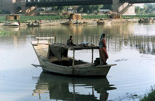
 A search on Flicker produced a good ground level view of the two bridges and some nice images of the river at this point.
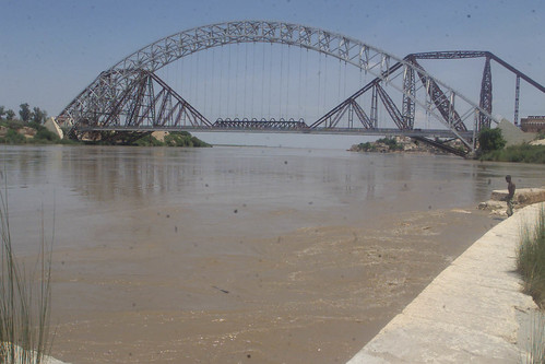


No comments:
Post a Comment