 Although the edge of the Deccan plateau just pushes into the south of Bihar, most of the state is, like Uttar Pradesh , a very flat and fertile lowland area - occupying the flood plains of the Ganges and its many tributaries. Like Uttar Pradesh, the fertility of the land supports a very large population of some 83 million people making it India's third most populous state.
 Mark's last logged position today puts him some 50 miles north west of Patna, the capital of Patna in an area where yet again there are a rich assortment of river landscapes which have been so much a feature of this section of Mark's journey. Last night was spent in the vicinity of Gorakhpur , surrounded by meandering river courses, shifting flood plains and ox bow lakes....
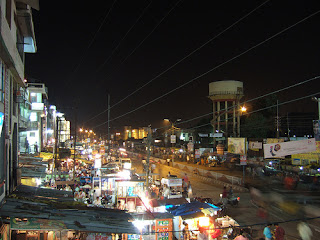
 Unlike large tracts of Iran and Pakistan, there are fewer areas in the north of India where Google maps are returning high resolution imagery and so we have to content ourselves with more distant views of the ground. However, the river features stand out well even from a high altitude and luckily Flickr produced some lovely images of Gorakhpur which give a good impression of this city of 1.3 million people. As Mark says, the sheer numbers of people are amazing. Here is yet another million city which most of us following Mark's route will not even have heard of!


The water tower in the last view is interesting. In an area which is so flat and so close to sea level despite being still 400 miles from the Bay of Bengal, it will be the only way to get water pressure. The last image (below) is also Gorakhpur - during the wet season. if you click the image, it links to a good animation which explains the seasonal shift of the windsand the arrival of the monsoon in India.


No comments:
Post a Comment