 From the air it looks much like many of the other settlements on the edge of the desert which he has travelled through in the last couple of days. Like Rafsanjan and Kerman, it is located where a seasonal river provides enough water to support irrigation and cultivation. Unlike Rafsanjan and Kerman, however, it is not its agricultural commodities or Persian carpets for which it is noted but rather the huge death toll which followed an earthquake there on 26th December 2003. A closer look at the area from the air reveals clear evidence of the disaster...
 ..temporary shelters (probably tents) surrounded by buildings which lie destroyed. This imagery is probably a couple of years old but judging from the extent of the destruction visible in the city, it is doubtful if much reconstruction will yet have been achieved.
I have been saying that I know very little about the geography of Iran (much more now though having followed Mark through the country for two weeks) but ironically, the Bam earthquake and its aftermath I know quite well. Contrary to what some people may say, geography teachers do not 'enjoy' a good natural hazard but we do try to make sense of them for our pupils. Pupils need to understand where and why these natural phenomena occur but, more importantly, realise that it is the state of preparedness of the population which turns a hazard into a disaster. Some societies can prepare better than others. There is a very good exemplification of that idea here.
As for the disaster in Bam, there is an abundance of material which I can share with you, much of it courtesy of two 'virtual' colleagues, (Geography teachers in England), who put together links on their school blogs to web based video footage, photographic records and newspaper reports. Look here and here for their treasury of resources.
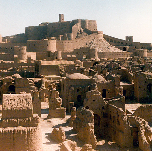
Sadly the 2000 year old citadel, one of the largest adobe mud structures in the world and seen here before 2003, was virtually destroyed by the 'quake.
With thanks to my two virtual colleagues Rob Chambers and Noel Jenkins who have saved me a lot of surfing this evening.


No comments:
Post a Comment